The paths for the drawing of Rome
DOI:
https://doi.org/10.15168/xy.v4i8.154Keywords:
mythology, Rome, topographyAbstract
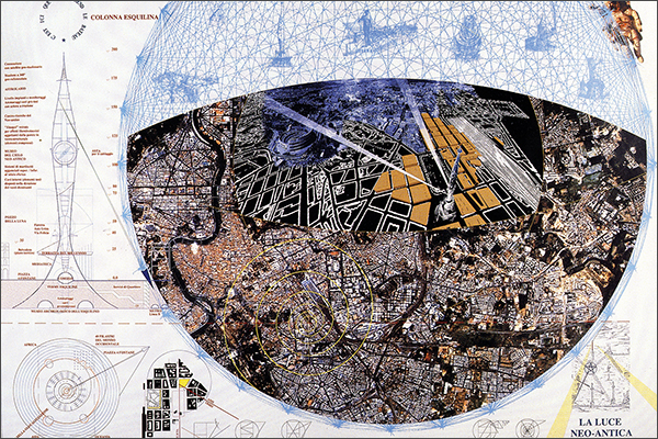
Archaeological studies and antiquarian visions by an architect who was director of the Flavian Amphitheater underline landscapes and memories of Mediterranean, measuring them by the geo‒astronomical patterns hidden in the maps of Rome. The checkpoints of that foundation memorize a topographical code practiced by triangulations which links the natural paths by registering them as historical ‘shadows’ drawn over the labyrinthian map of Rome designed between earth and sky. Monumental testimonials talk each other at distance with a double geometrical substance locally configured thanks to the axis urbis that unitarily holds up patterns and gives order to ways referable to a sky cardo who crosses on earth the decumanus of Rome. The Roman groma unit of measurment is thus confronted with the archaeological‒astronomical data discovered and necessary to rearrange the quality of the ancient network and to recognize the identifying topoi of space‒time, the sites scattered between the center and the peripheries to be re‒read as distinct parts of the same archaeological whole. Ab urbe condita the identity of the urban drawing therefore underlines the unified figure of a model with ‘quantum stations’ that historicizes the scientific data of the archaeological excavation, helping to understand and make productive the stratigraphic geometries of the material and immaterial values that are dispersed and never lost. The primary topographical knots and the historicized by−groma technical measures characterize the heterotopic way of planning that regenerates figures and paths of invention to link the center to the distant peripheries, always through the axiomatic identity geometry of the axis, highlighted even in the Forma Urbis Romae table too. The modern territory, recomposed with the guidance of the secret code of the axis urbis and represented as the cross shape of a double drawing, will be able to regenerate the ancient layouts of the urban labyrinth and to propose innovative spatial figures for the common good in the digital age (‘Bi‒Sogno’ of Rome).